We’re travelling beyond the mainland once more, and the Canary Islands is our destination. We don't like the idea of taking flights for our trips, and we have virtually stopped travelling this way, but when it’s necessary, to go to another landmass, we take action to offset CO2 emissions by supporting projects aimed at protecting the environment. Choosing these islands to explore their mountain ranges and volcanoes is actually a bit unusual. An incredibly popular destination for surfers, here we intend to explore the opposite environment to what we saw in Switzerland. Fuerteventura with its mountains and volcanoes is an extremely striking place.
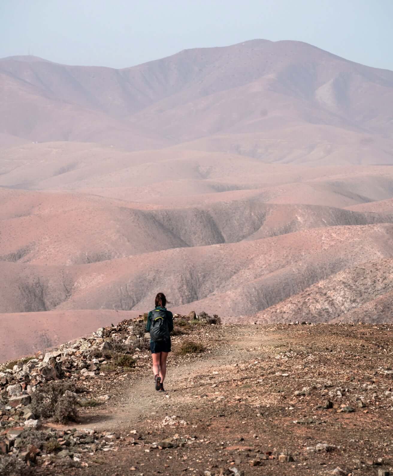
We start exploring the south, in the area of the Jandia Natural Park. From the Mirador de Cofete we climb back up north to reach the Degollada de Cofete. Looking to the west, the contrast between the colours of the ocean and the coast is remarkable. We walk in environments where the elements of nature unleash their full force.
We start exploring the south, in the area of the Jandia Natural Park. From the Mirador de Cofete we climb back up north to reach the Degollada de Cofete.
Looking to the west, the contrast between the colours of the ocean and the coast is remarkable. We walk in environments where the elements of nature unleash their full force. The northernmost viewpoint is battered by strong winds, and clouds gather on the ridge, suggesting that we descend to the valley and head further north.
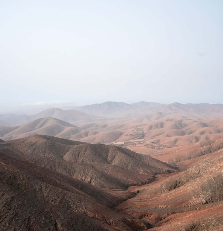
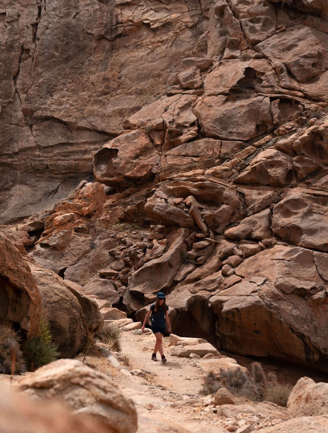
We move towards the central area of the island, from Cardón, a mountain with steep terrain sculpted by erosion that stands out for its shape and imposing height (one of the highest peaks on the island) in the characteristic flat landscape of Fuerteventura, towards the Sicasumbre observation point. The scenery is impressive and the colours of the terrain are reminiscent of landscapes in sci-fi films about life on Mars. In general, the landscape that the Natural Monument of the Mountain of Cardon boasts has little in the way of colour contrasts, but is incredibly beautiful in its geomorphological forms.
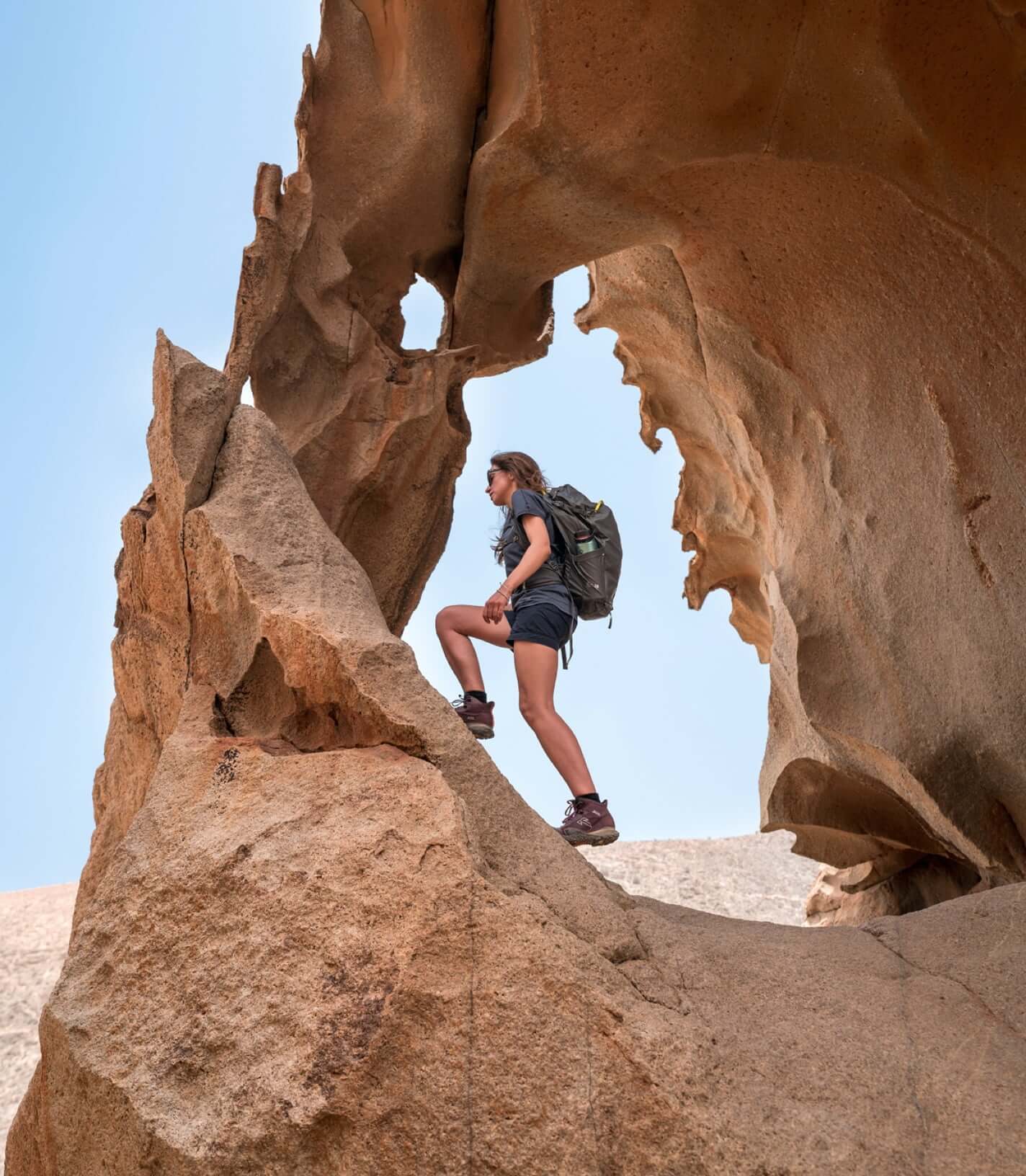
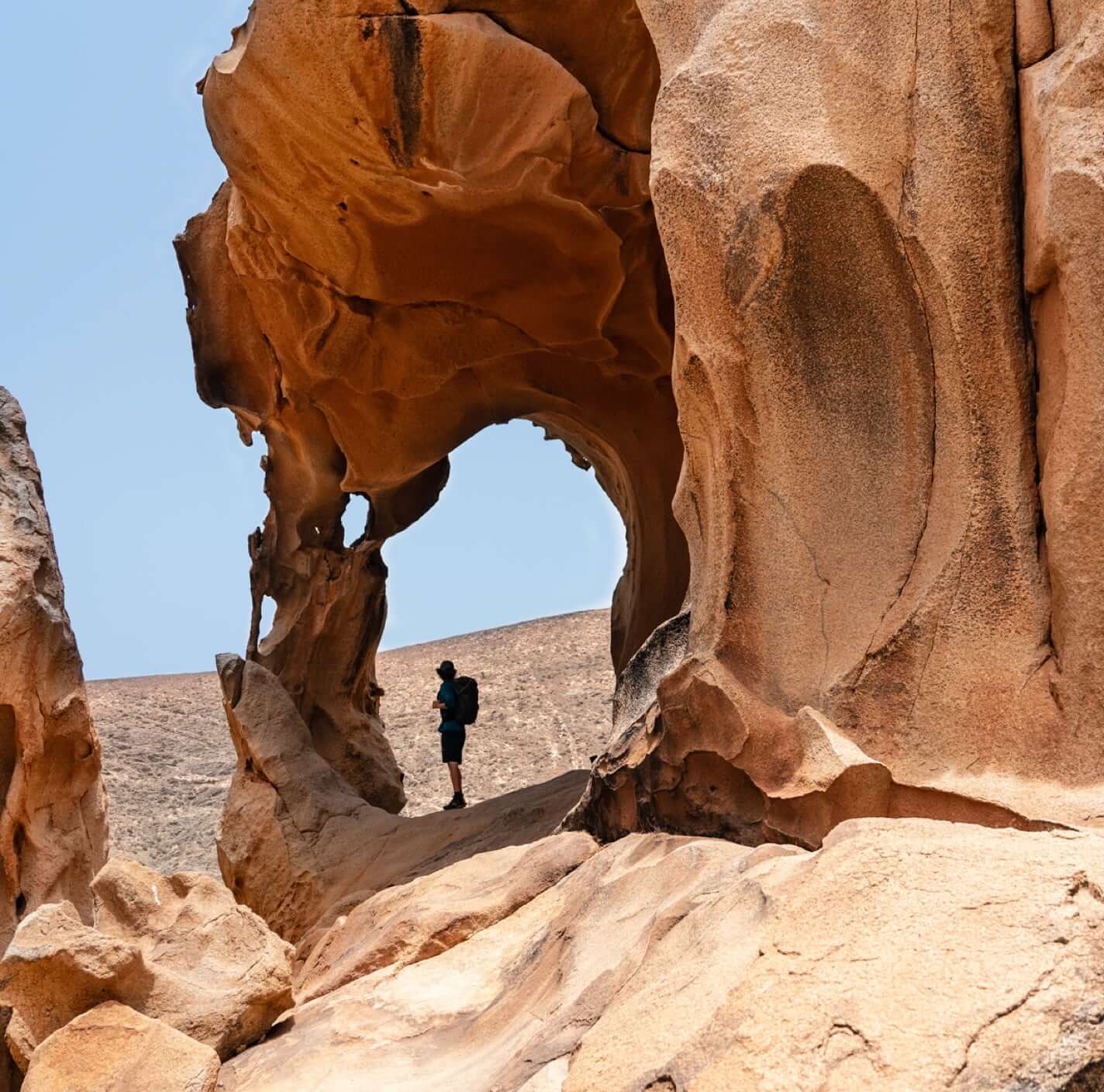
We treat ourselves to a day of kite surfing before exploring one of the most famous places on the island, Arco de Las Peñitas. The path to reach the arch, which is located at one of the summits of Barranco de Las Peñitas, is steep and not signposted, the temperature is very high and it takes a lot of effort to reach the summit.
After about an hour we finally reach the arch: a true natural work of art. The wind and sand have sculpted the stone over the centuries. This orange-red arch contrasting with the blue sky is an image to remember.
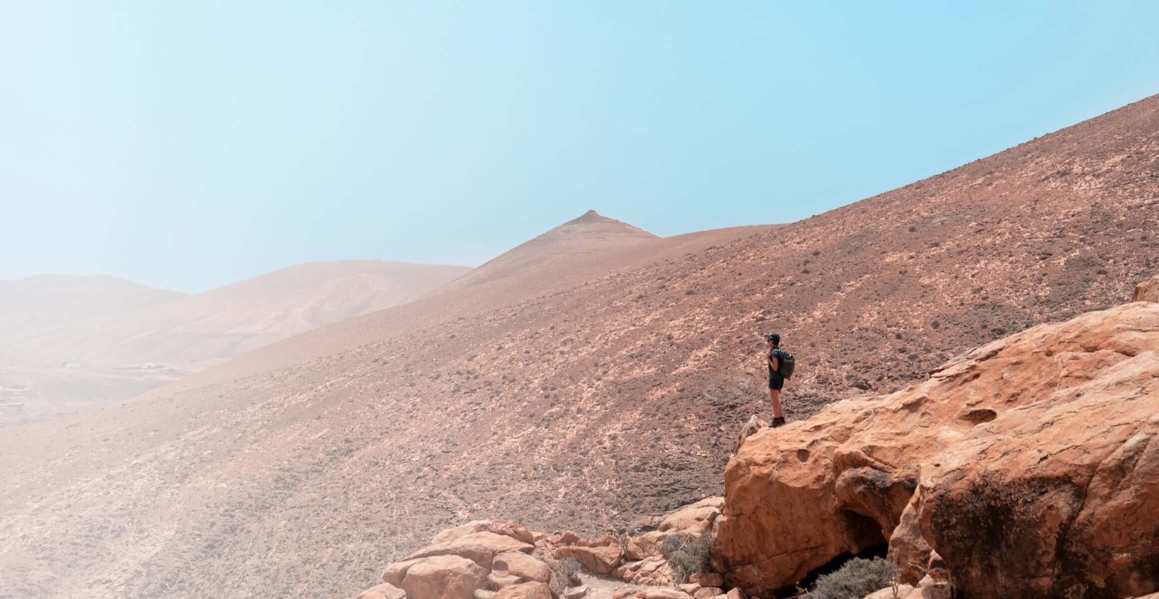
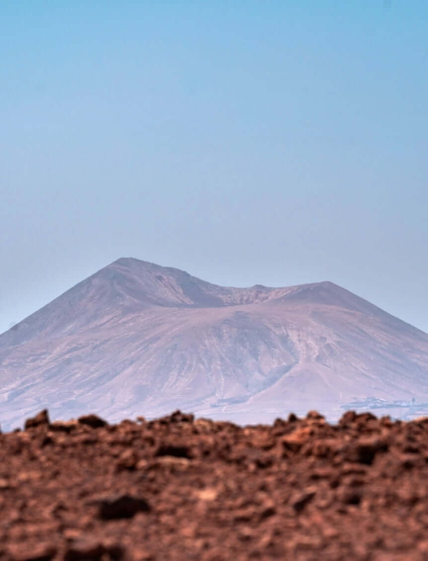
As planned, we spend the last few days in the north of the island. Our destination is Caledron Hondo. Climbing to the summit is a unique experience, and in the area there are several other volcanoes, around 50,000 years old. At the highest part of the crater, around 280 metres up, the view of the other volcanoes is really something. A walk around the mouth of the volcano gives us the opportunity to admire the landscape of the northern part of the island: El Cotillo, Majanicho, and Lanzarote in the distance. The igneous rock provides an idea of just how much force was released from the earth during the eruptions that created these conical structures that today offer an unparalleled natural landscape.
It is time to return to the mainland, and we are delighted with such an intense experience in an environment that is unusual for us, with temperatures that have been very high at times, rugged terrain, orange-red colours, and no vegetation - a unique experience.